
While traditional seismic networks require expensive underground sensors, crowdsourced mobile data allows for rapid earthquake detection in regions lacking government infrastructure. The landscape of seismology is undergoing a radical shift as the world moves from centralized, government-run detection systems to decentralized, crowdsourced models. At the heart of this transformation is the smartphone, a device found in the pockets of billions, now serving as a critical tool for disaster mitigation. By leveraging the built-in hardware of the global Android ecosystem, technology giants have created a safety net that can detect tremors and alert populations faster than traditional methods in many parts of the world. This evolution was recently demonstrated during a powerful seismic event in Venezuela, where two earthquakes, including a massive 7.5 magnitude tremor, struck the region. While local governmental institutions were only able to record the data after the event had occurred, the Android Earthquake Alerts System provided residents with those few, precious seconds of lead time. For many, this gap between the alert and the shaking was the difference between being trapped and finding safety in the street. This shift represents a fundamental change in how humanity approaches natural disasters, moving away from a reliance on rare, expensive equipment toward a ubiquitous, software-driven protective layer that acts as a global immune system for tectonic shifts.
The Technological Foundation of Mobile Detection
Turning Consumer Hardware: The Role of Accelerometers
The primary sensor making this possible is the micro-electro-mechanical system (MEMS) accelerometer, a standard component in modern smartphones used for screen rotation and fitness tracking. These sensors are incredibly sensitive, capable of detecting the subtle “P-waves” or primary waves that precede the more destructive “S-waves” of an earthquake. By recruiting over two billion devices into a unified network, the system creates a massive, global sensor array that can distinguish between the noise of daily life and the distinct vibrations of a tectonic shift. When a phone is stationary and plugged into a charger, its sensitivity increases, allowing it to act as a mini-seismometer. The sophisticated algorithms running on these devices are designed to filter out local vibrations, such as a heavy truck passing by or a phone being dropped, by looking for specific frequency patterns characteristic of seismic activity. This transformation of a consumer gadget into a scientific instrument has fundamentally altered the economics of disaster preparedness, allowing for high-density sensor coverage in urban areas where installing traditional underground stations would be cost-prohibitive and logistically impossible.
The success of this method relies on the power of crowdsourced sensing, where data from thousands of phones is aggregated to ensure accuracy and eliminate false positives. A single phone falling off a table might look like a tremor to an isolated sensor, but when thousands of phones in a specific neighborhood report the same vibration pattern simultaneously, the system can confirm a seismic event with high confidence. This collective intelligence allows for a level of geographic coverage that traditional underground sensors simply cannot match, especially in developing regions. As the density of smartphones continues to increase, the resolution of this virtual seismic network improves, allowing scientists to map the progression of a quake in real-time with unprecedented detail. The decentralized nature of this data collection also provides a level of redundancy; even if some cell towers or local nodes are damaged by the initial shock, the mesh of remaining devices can continue to feed vital telemetry to central processing hubs. This resilience is a hallmark of modern distributed computing applied to public safety, ensuring that the flow of information remains steady even when the physical environment is in a state of chaos.
Understanding the Physics: Light Versus Seismic Energy
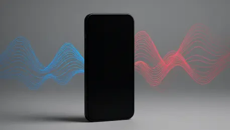
The system operates on the fundamental principles of wave physics, specifically the speed difference between light and seismic energy. When an earthquake occurs, it releases primary waves that travel quickly but cause little damage, followed by secondary waves which are slower but carry the destructive force. Because the information from a phone’s sensor can be transmitted to a server at the speed of light via fiber optic cables and cellular networks, the alert can literally outrun the earthquake. In practical terms, this means that while a seismic wave might travel at a few kilometers per second, the notification travels at nearly 300,000 kilometers per second. This temporal advantage is the cornerstone of early warning technology, providing people with the time necessary to take protective actions before the ground begins to shake violently. The efficiency of the data processing pipeline is critical here, as every millisecond spent on server-side validation is a millisecond lost for the user on the ground. Modern cloud infrastructure has matured to the point where these calculations happen in the blink of an eye, turning raw sensor data into actionable alerts across entire continents.
In the case of the Venezuelan earthquake, the system demonstrated remarkable efficiency in a real-world high-stakes scenario. Users near the epicenter detected the initial primary waves within three seconds, and by the ninth second, the central algorithms had confirmed the event and pushed out the first batch of alerts to surrounding regions. As the seismic energy spread, the system continuously updated its calculations, expanding the alert radius and providing those further away with even more time to prepare for the impact. This dynamic scaling is a significant improvement over older, static systems that often struggled to update their warnings as a quake increased in magnitude. By utilizing the low-latency nature of modern 5G and LTE networks, the system ensures that the alert reaches the widest possible audience in the shortest possible timeframe. This capability is particularly vital in coastal regions where an inland earthquake might trigger a tsunami, as those extra seconds can be used to begin evacuations to higher ground before the secondary threats even materialize. The integration of physics and high-speed networking has turned what was once a theoretical possibility into a daily reality for millions of people living on active fault lines.
Global Implementation and Scientific Validation
Measuring Impact: Validating Results with Large Datasets
The effectiveness of smartphone-based warnings is no longer just theoretical; it has been validated by extensive peer-reviewed research and real-world performance metrics. A study covering the system’s operation across nearly 100 countries revealed that it successfully detected thousands of significant earthquakes and pushed out hundreds of millions of alerts to at-risk populations. This global infrastructure has proven particularly effective at night, when stationary phones on bedside tables act as highly sensitive, low-noise monitors, providing a quiet environment for the sensors to pick up even the faintest deep-earth vibrations. Researchers have used this data to fine-tune the detection thresholds, reducing the number of “ghost” alerts while ensuring that genuine threats are never missed. The sheer volume of data generated by these devices provides a secondary benefit to the scientific community, offering a granular look at how seismic waves move through different soil types and urban structures, which can inform future building codes and city planning. This symbiotic relationship between public safety and academic research has accelerated our understanding of planetary mechanics in ways that were previously unimaginable.
Feedback from users has been overwhelmingly positive, with the vast majority rating the alerts as “very useful” in post-event surveys conducted from 2026 onward. Beyond the technical data, the psychological impact of receiving a warning cannot be overstated, as it provides a sense of agency in a situation that usually feels entirely outside of human control. Even five to ten seconds of notice allows an individual to move away from glass windows, drop to the ground, or exit a fragile structure, significantly reducing the likelihood of injury or death during the initial violent shaking. In many documented cases, parents used those few seconds to shield their children or shut off gas valves, preventing secondary disasters like residential fires. The normalization of these alerts has also fostered a more disaster-aware culture, where people are better prepared to react instinctively rather than panicking. This shift in public behavior, supported by reliable and timely technology, is perhaps the most significant long-term benefit of the crowdsourced model. By turning the global population into both sensors and recipients of safety data, the technology has created a shared responsibility for disaster resilience that transcends national borders.
Navigating the Last Mile: Delivering Life-Saving Notifications
A critical component of any early warning system is the “last mile”—the actual delivery of the message to the person in danger. Different nations have adopted various strategies to ensure these alerts are seen and acted upon immediately. In regions like the United States and Japan, cell broadcasts are used to bypass network congestion and override silent modes, ensuring that the warning is the first thing a user sees and hears regardless of their phone’s settings. Meanwhile, in China, the system has been integrated into smart TVs and community sirens, providing a multi-layered approach to public safety that reaches people even if they are not looking at their mobile devices. This diversification of delivery channels is essential for reaching vulnerable populations, such as the elderly or those with disabilities, who might not interact with smartphones in the same way as younger generations. The goal is to create a “surround-sound” of safety information that is impossible to ignore, leveraging every connected screen and speaker in a given geographic area to broadcast the emergency signal.
However, the “last mile” also reveals gaps in the current technological ecosystem that require urgent attention from industry leaders. For example, in certain regions, some popular smartphone platforms still lack the deep system-level integration required for instantaneous native alerts, forcing users to rely on third-party apps that may be delayed by background processing restrictions. This discrepancy highlights the need for universal standards in emergency broadcasting to ensure that every citizen, regardless of their device choice or operating system, has access to life-saving information. Technical challenges such as battery optimization and data privacy also play a role, as the system must remain active without draining the device’s power or compromising the user’s location data. Engineers have addressed these concerns by using on-device processing for initial detection, only sending anonymized metadata to the cloud when a potential event is triggered. Moving forward, the industry must focus on creating a truly platform-agnostic framework for emergency alerts, ensuring that the infrastructure of safety is as universal as the cellular networks that support it.
Limitations and the Future of Seismic Safety
The Inherent Boundaries: Addressing the Seismic Blind Zone
Despite the revolutionary nature of this technology, it is not a perfect solution and faces inherent physical limitations that must be clearly communicated to the public. The most significant of these is the “early warning blind zone,” which exists within a 25-kilometer radius of the earthquake’s epicenter. In this area, the destructive secondary waves arrive almost simultaneously with the primary waves, leaving no time for the system to process the data and send an alert before the shaking begins. For residents living directly on top of a major fault line, the phone in their pocket may only begin to buzz once the building is already swaying. Understanding this limitation is vital for managing expectations and ensuring that people do not become complacent. While technology can provide a massive advantage to those further away, it cannot yet overcome the basic constraints of distance and wave velocity. Consequently, traditional earthquake preparedness—such as retrofitting buildings and storing emergency supplies—remains just as important as the digital warnings themselves.
It is also important to distinguish between earthquake warning and earthquake prediction, a distinction that is often blurred in the popular imagination. Current technology cannot tell us when an earthquake will happen days or even hours in advance; it remains a reactive system that buys time only once the event has already started. While machine learning models are being trained on massive datasets to look for pre-seismic anomalies, we have not yet reached a point where reliable prediction is a reality. The focus of the current technological push is on maximizing the “warning” phase—extending those few seconds into a minute or more for those at a distance. As sensor density increases and data processing speeds improve, the size of the blind zone may shrink slightly, but it will never disappear entirely due to the laws of physics. The future of seismic safety lies in a hybrid approach that combines these rapid mobile alerts with automated industrial responses, such as automatically slowing down high-speed trains, stopping elevators at the nearest floor, and isolating power grids to prevent catastrophic failures.
Global Equity: Democratizing Earthquake Protection Tools
The most profound impact of smartphone-based alerts was the democratization of safety across diverse socioeconomic landscapes. Historically, only wealthy nations could afford the massive capital investment required to install and maintain traditional seismic networks consisting of hundreds of high-precision underground stations. By utilizing existing consumer hardware, sophisticated early warning capabilities became available in developing nations and regions with limited government infrastructure. This shift allowed countries in Southeast Asia, Latin America, and Africa to leapfrog traditional development cycles, gaining access to world-class disaster mitigation tools without the need for multi-billion dollar grants. The cost of maintaining the system was absorbed by the existing cellular infrastructure and the technology companies that manage the software, making it a sustainable model for long-term growth. This accessibility ensured that a resident in a remote village had the same access to life-saving data as a corporate executive in a high-rise office, bridging a critical gap in global public health.
The implementation of these systems established a new paradigm where big data and crowdsourced hardware were harnessed to protect human life on a global scale. Researchers observed that as more people opted into these programs, the network effect significantly enhanced the reliability of the alerts for everyone. The focus eventually shifted toward integrating these mobile warnings into a broader ecosystem of “smart city” infrastructure, where the data from phones could trigger automated shut-off valves for municipal water and gas lines. This evolution transformed the smartphone from a tool of daily convenience into a critical instrument of survival that functioned as part of a larger, coordinated defense against natural disasters. The success of the project demonstrated that the most effective solutions to global challenges often come from repurposing the tools people already carry with them. By the time the system reached its current maturity, the “window of survival” had widened for millions, proving that the collective power of personal technology could effectively mitigate the ancient threat of the shifting earth. Consistent efforts were made to ensure that privacy protections remained robust, which fostered the high levels of public trust necessary for the system to function at its peak capacity.